[AT × SG Prospects] Remote Sensing Technology Made Great Contributions Philippines Environmental Protection Blade Unsheathed
The Philippine Space Agency has established a partnership with an international non-governmental organization to bring the Philippines' environmental protection efforts to a new stage through innovative applications of remote sensing technology.。
Recently, the Philippine Space Agency (Philippine Space Agency, hereinafter referred to as "PhilSA") has established a partnership with an international non-governmental organization, the organization's mission is to protect the Earth's biological heritage and global biodiversity, through the innovative application of remote sensing technology, environmental protection and follow-up management to a new level。
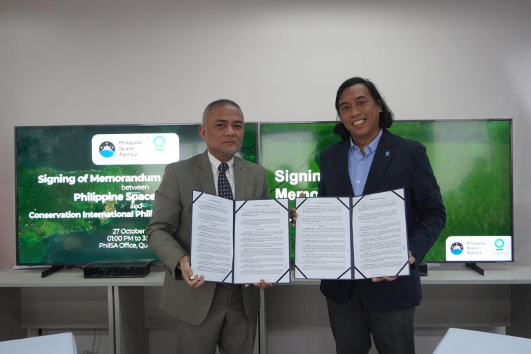
In the presence of the Director of the Space Information Infrastructure Bureau (SIIB) of PhilSA, Dr. Joel Joseph Marciano, Director General of PhilSA, together with other collaborators, signed a Memorandum of Agreement (MoA), marking the beginning of this important collaboration.。
Dr. Joel praised the organization's leadership in global environmental protection efforts, especially its innovative "From Highlands to Oceans" (H2O) approach, which covers a range of environmental strategies, from natural landscapes to climate adaptation, and disaster risk reduction.。
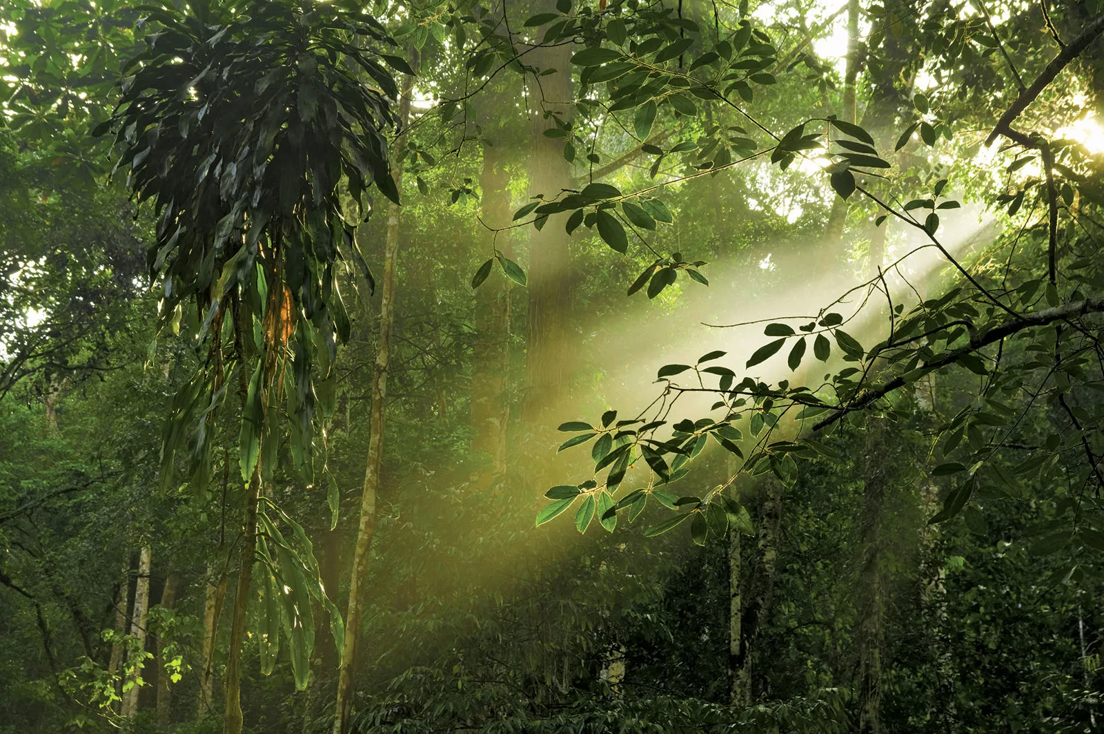
The key to this cooperation is that it has the potential to completely change the environmental protection model in the Philippines.。By harnessing satellite and aerial remote sensing, PhilSA opens the door to a deeper natural world。
It is understood that this cooperation is of great significance in many aspects:
First, the project aims toUse of space technology for ecosystem research, conservation and sustainable management。Monitoring of critical habitats such as mangroves and seagrass beds has the potential to provide useful information for related natural and community conservation projects.。
It also supports a strategic plan conservation project called "The Mantalingahan Landscape Conservation Project in Southern Palawan," which aims to improve the management of protected landscapes and open the way for greater forest protection.。
Second, PhilSA believes that the significance of remote sensing technology lies in its ability to effectively collect data on a large scale, thus enabling a more comprehensive and accurate assessment of the state of the environment.。This not only enhances the understanding of ecosystems, but also contributes to the sustainable management of natural resources such as forests and fisheries, and better maintains their long-term viability。
In the face of climate change, remote sensing technology provides important data for understanding and responding to its impact on the environment and the resilience of local populations.。Conservation planning has also benefited greatly by helping to prioritize and allocate resources to make planning more effective。
For countries with frequent natural disasters such as typhoons and volcanic eruptions, remote sensing technology is equally important for disaster management.。It can assess and respond to them in a timely manner, thereby minimizing the impact of such events on ecosystems and communities。
Not only that, the cooperation also provides strong support for environmental protection related knowledge and skills training。From training in satellite data processing and unmanned aerial mapping to knowledge exchange and learning in sustainable development and space science and technology applications, the knowledge-sharing component of the cooperation will greatly enhance the capacity of local communities and organizations to provide them with the appropriate tools and skills。
PhilSA said that the depth of this partnership will not only provide a large amount of reliable data, but also develop a group of skilled professionals to continue to promote the progress of environmental protection.。This cooperation symbolizes the Philippines' strong commitment to "protecting natural heritage and building a sustainable future," and remote sensing technology has since served as a cutting edge to help the Philippines' environmental protection journey.。
·Original
Disclaimer: The views in this article are from the original Creator and do not represent the views or position of Hawk Insight. The content of the article is for reference, communication and learning only, and does not constitute investment advice. If it involves copyright issues, please contact us for deletion.


![[Singapore Stock Market] Strong Momentum: Raffles Medical Group and ISDN](https://hawk-oss.hawkinsight.com//picture//202402/2212555830_871.jpg?w=3840&q=100)